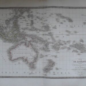
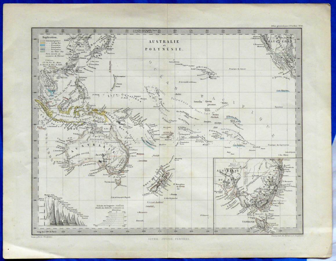
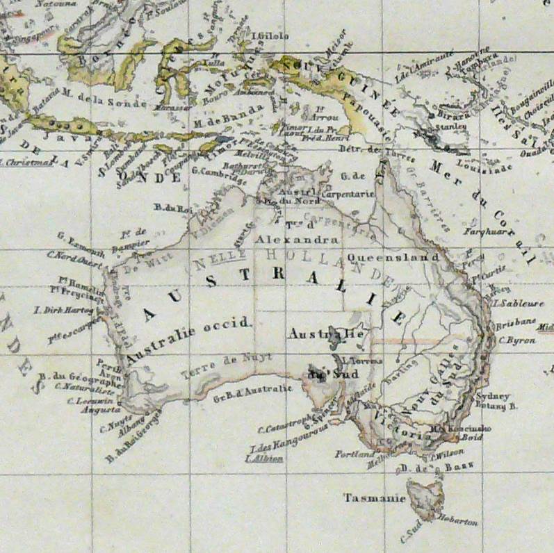
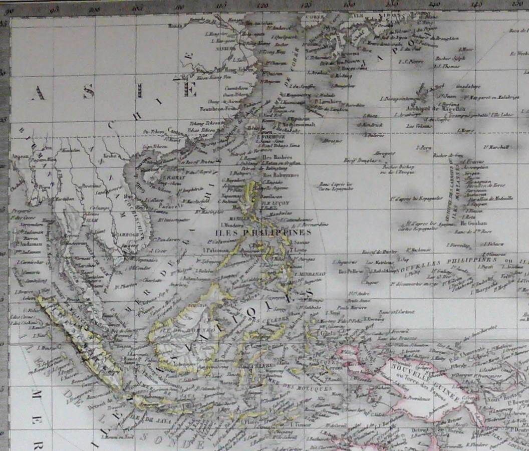
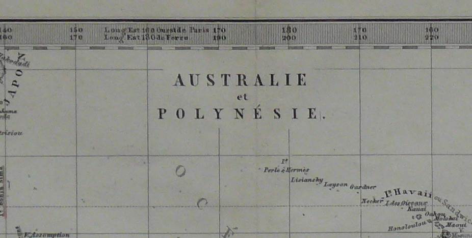
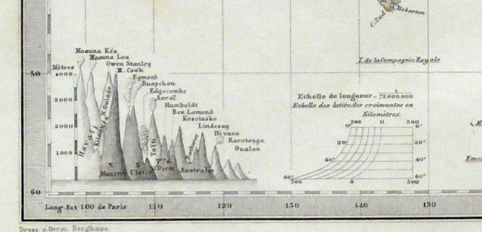
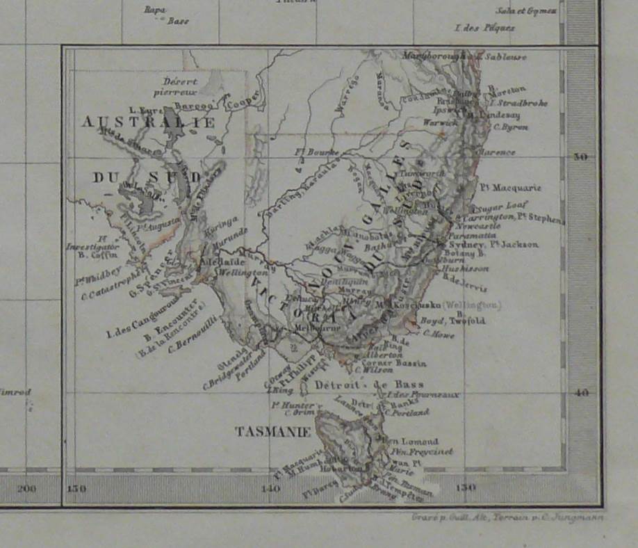
Antique coloured copper engraving map of Australia and Polynesia
Condition: Map is in excellent condition minimal yellowing along leaf.
Please see pictures.
$165.00 AUD
Availability: 1 in stock
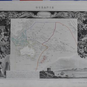
Antique coloured copper engraving map of Australia and Polynesia
Condition: Map is in excellent condition minimal yellowing along leaf.
Please see pictures.
| SKU |
|---|
1880 from the Atlas Gotha Justus Perthes
Sheet size: 31.4 x 24.5 cm
Map size: 26 x 20 cm
Johann Georg Justus Perthes (September 11, 1749 – May 2, 1816) was a German Publisher and founder of the firm that bears his name (Justus Perthes).
He was born in the Thuringan town of Rudolstadt. From 1778 he worked as a bookseller in nearby Gotha, where he founded the cartographic publishing firm Justus Perthes Geographische Anstalt Gotha in 1785. In this, he was joined in 1814 by his son Wilhelm Perthes (1793–1853), who had been in the publishing house of Justus’s nephew. On Justus’ death in Gotha, Wilhelm took over the firm and laid the foundation of the geographical branch of the business for which it is chiefly famous, by the first publishing of the Hand Atlas from 1817–1823 after Adolf Stieler (1775–1836).
Wilhelm Perthes engaged the collaboration of the most eminent German geographers of the time.
In 1866 the elaborate Geographisches Jahrbuch was produced under the editorship of Ernst Behm (1830–1884), on whose death it was continued under that of Professor Herman Wagner.
Justus Perthes Geographische Verlagsanstalt Darmstadt was a publishing firm in Darmstadt from 1953 to 1994.
*All biographical information taken from Wikipedia for educational purposes only


Select at least 2 products
to compare